
 Cross-border
- Proximités croissantes FR
The multiplication of activities has progressively led to their being assigned boundaries and specially reserved zones. Indeed historically, it is in the Channel that the first legally established boundaries based on international law (Bay of Granville Convention 1839-1843) were introduced.
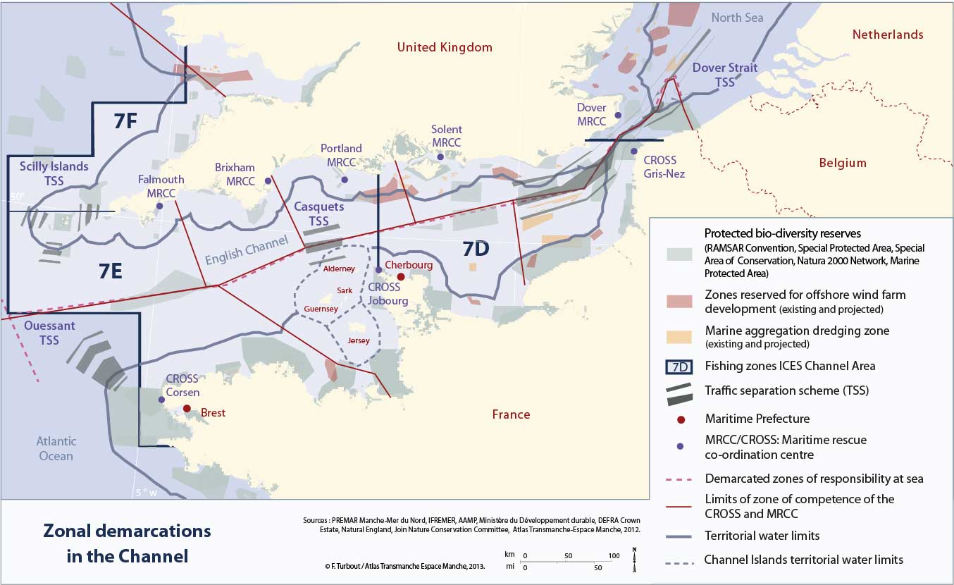
As such the sea component of the Channel has become increasingly viewed in territorial terms. Internally, it is therefore organised with reference to marine area use plans. By identifying the zonal boundaries, the areas of jurisdiction and those parts reserved for specific activities, the Channel is aspiring to become a fully managed, developed as well as protected space.
Above all the whole area defined by the management limits in question, the first of which are the territorial sea limits within which French and British sovereignty reigns including those specific to the Channel Islands.
Superimposed on this first level are those additional areas of marine responsibility defining where French and British authorities are allowed intervene in the event of an accident. These areas of responsibility are between those covered by sea rescue and surveillance centres in France (CROSS: Regional Operational Centres of Surveillance and Sea Rescue) and in England (MRCC: Maritime Rescue Coordination Centre). The latter are tasked with keeping an eye on maritime traffic and carrying out rescue missions in the event of accidents or shipwreck.
The maritime use plan additionally takes account of zones reserved for any specific resource development. Fishing zones established by the International Council for the Exploration of the Sea (ICES) cover the whole of the Channel. These allow for a regular census of the resource fished by the various maritime professionals. These more broadly defined zones encompass more restricted areas reserved for the extraction of aggregates, shellfish farming and operation of offshore wind farms.
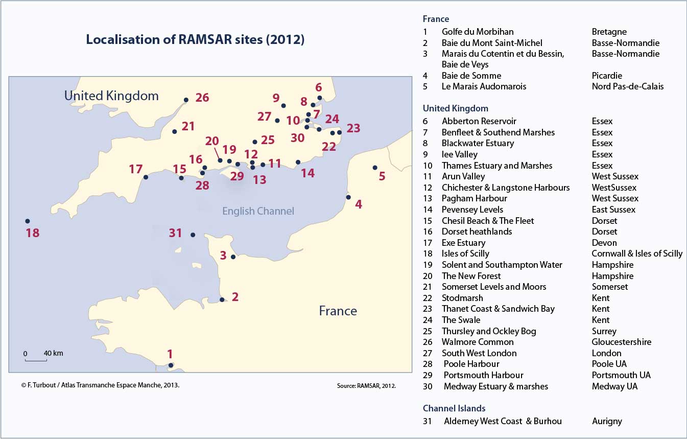
Finally, it should be emphasised that this system of the superimposition of boundaries and zones defined over the decades is itself further subject to a wide array of regulations categorising the parts of the area to be set aside for protecting biodiversity. Protected Marine areas belong to this category, as do RAMSAR zones, special protection and conservation zones as well as the Natura 2000 network.
The schema produced by this series of boundaries – albeit invisible to the naked eye – underpins the Channel marine use management plan.
top


